After nearly eighteen months
into their historic journey, which began May 14th
1804 from Wood River near St. Louis, thence to the
mouth of the Columbia River, the Corps of Discovery
reached the westernmost extent of their travels. On
November 16th 1805 Gass wrote in his journal: "We
are now at the end of our voyage, which has been
completely accomplished according to the
expectations of the expedition, the object of which
was to discover a passage [the fabled Northwest
Passage] by way of the Missouri and Columbia rivers
to the Pacific ocean..." On that same day,
Whitehouse wrote: "We are in now plain view of
the Pacific Ocean. the waves rolling, & the surf
roaring very loud...We are now of opinion that we
cannot go any further with our Canoes, & think that
we are at an end of our Voyage to the Pacific Ocean,
and as soon as discoveries necessary are made, that
we shall return a short distance up the River &
provide ourselves with Winter Quarters." Lewis
traveled on that day, through Baker Bay, to explore
Cape Disappointment and the (Long) beaches to the
north. He returned the following day to a place
called Station Camp, to rejoin the remainder of the
Corps encamped there.
The location of Station Camp, where these above
journal entries were written, has been established
as being across from present-day Astoria, on the
Washington side, near the Astoria/Megler Bridge --
crossed by the old Nomad the next-to-final
day during Odyssey 2004. At Station Camp, the
Captains took a vote to decide where best to locate
winter quarters. All members of the Corps had a
say. Historically, and although not within the then
bounds of the United States, this was the first vote
cast by either a woman or a black -- many years
before either would suffer that privilege of
citizenship. Of the twenty-eight or so votes cast,
the majority chose to cross the Columbia and seek a
suitable camp from that upriver side, the belief
being that the most elk were to be found there.
On November 26th 1805 the Corps turned and proceeded
up the north shore of the Columbia, seeking a point
to cross that vast body of water. Later that day,
and under the most dreadful conditions they
successfully made the crossing. Weather conditions
continued to worsen. Of that time and experience,
and on November 28th 1805 Clark wrote: "rained
all the last night we are all wet our bedding and
Stores are also wet, we haveing nothing which is
Sufficient to keep ourselves bedding or Stores
dry...this is our present Situation; truly
disagreeable. about 12 oClock the wind Shifted
around to the NW. and blew with Such violence...O!
how disagreeable is our Situation dureing this
dreadful weather."
The following day Lewis wrote:
"the wind being so high the party were unable to
proceed with the perogues. I determined therefore to
proceed down the river...in surch of an eligible
place for our winter residence and accordingly set
out early this morning in the small canoe
accompanied by 5 men."
On December 1st 1805 and still searching for a
suitable winter campsite, Clark wrote: "The
emence Seas and waves which breake on the rocks &
Coasts to the SW. & NW roars like an emence fall at
a distance, and this roaring has continued ever
Since our arrival in the neighborhood of the Sea
Coast which has been 24 days Since we arrived in
Sight of the Great Western; (for I cannot Say
Pacific) Ocian as I have not Seen one pacific
day..." On December 5th 1805 Gass wrote:
"There is more wet weather on this coast, than I
ever knew in any other place; during a month, we
have had three fair days; and there is no prospect
of a change."
On December 7th 1805 the Corps arrived at the place
they named Fort Clatsop. On that day, Clark wrote:
"...we assended a river [Lewis and Clark] which
falls in on the South Side of this Bay [Youngs]...on
a rise about 30 feet higher than the high tides
leavel...this is certainly the most eligible
Situation for our purposes..."
From December 7th 1805 to March 22nd 1806 the Corps
remained at Fort Clatsop. During that three and
one-half months Clark noted that there had been only
six days with any sunshine, and only twelve without
rain. Once the fort was built, they settled in to
occupy their time with routine chores and
activities. The better hunters hunted, others made
salt, put in needed provisions, made/repaired
clothing and gear. All traded with the Indians.
Gass noted on March 13th, 1806 that "I this day
took an account of the number of pairs of mockasons
each man in the party had; and found the whole to be
338 pair."
During the winter at Fort Clatsop, Clark worked his
maps and Lewis expanded the field notes he'd
gathered concerning zoological, botanical and
anthropological data. The Captains also toiled much
over their detailed plans for the Corps' return. The
Captains had intended to break winter camp no
earlier than the first of April. However, due to
the uncertain weather, they determined to set out
for the mountains much earlier, there to wait out
the snowmelt.
And so, on March 23rd 1806 the Corps began their
return journey. On that day Clark wrote: "This
morning proved So raney and uncertain that we were
undeturmined for Some time whether we had best Set
out..." Later in the morning "...the rain
Seased and it became fair about Meridean, at which
time we loaded our Canoes & at 1 P.M. left Fort
Clatsop on our homeward bound journey." In that
same entry Clark also noted that "...at this
place we had wintered and remained from the 7th of
Decr. 1805 to this day and have lived as well as we
had any right to expect..."
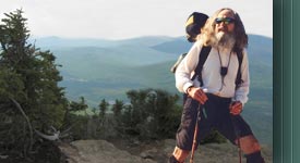
In 2004, the Nimblewill Nomad made his way from St.
Louis to Cape Disappointment on the Pacific Coast, just as
Lewis and Clark had done with the Corps of Discovery in
1804. In 2006 the Nomad has returned to
Fort Clatsop
, near Astoria, Oregon, to again walk in the 200
year footsteps of Lewis and Clark, as he follows their
return trip of 1806, all the way back to St. Louis -- where
it all began. The Nomad began his journey at
1:00 p.m. on March 23rd, which is the time and date indicated
by the original return expedition journals, and ended it in
St. Louis, on September 23, also indicated by the
original journals.
This odyssey is yet another
exciting and wonderful journey, packed
full with the spirit of both past and
present. So why not come along! Follow
the Nomad's day to day journal
entries as he completes this
historic journey. After 100 days on the
trail, Nomad interrupted his hike to let the Corps
"catch up." He returned to the trail on September 13th.
Those final nine days are highlighted below.
On Wednesday, September 13th,
the Nomad returned to the
Katy Trail, by the mighty Missouri
River, at Jefferson City, from there he
hiked the remainder of his 5,700 mile
round trip journey o’er the
Lewis and Clark National Historic Trail.
From the Katy trailhead at North
Jefferson, and on Wednesday the 13th,
he passed the
Osage River, where the Corps
encamped June 1-2, 1804, and again on
September 19th 1806, thence
on to the village of Steedman, a
distance of 22.0 miles. On
Thursday the 14th, he continued along
the Katy to McKittrick, a distance of
20.7 miles. On Friday the 15th,
it’s on to Marthasville (La
Charrette, the then gateway to the
American frontier), a distance of 22.7
miles. That day he passed the site of
the old
Daniel Boone settlement.
After the weekend off, the Nomad
resumed his hike on Monday the 18th,
along the Katy, from Marthasville to
Matson, a distance of 17.3 miles.
Tuesday the 19th he hiked
from Matson to
St. Charles, a distance of 21.9
miles. Wednesday the 20th
it’s St. Charles to West Alton, where
he picked up the
West Alton Trail, a distance of 20.2
miles. Thursday the 21st,
he crossed the Mississippi River into
Illinois (the last of eleven states
along the trail) o’er the
Clark Memorial Bridge, to pick up
the Levee Top Trail along the
Great River Road to
Camp Dubois at Wood River and the
Lewis and Clark State Historic Site
near Hartford, a distance of 19.4
miles. On Friday the 22nd,
and continuing along the levee, he
crossed the Mississippi River once more
o’er the old
US66 Chain of Rocks Bridge, to end
the day at the
gravesite of William Clark,
Bellefontaine Cemetery, a distance of
13.4 miles. The final day, Saturday the
23rd, and with friends and
family, he hiked the remaining 7.7
miles to the
Jefferson National Expansion Memorial
at
Gateway Arch in St. Louis (for the
Final National Signature Event),
200 years to the day of the Corps’
return.