|
| |
|
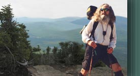
Odyssey 2009: North Country
National Scenic Trail (NCNST) |
|
Itinerary for Odyssey 2009 |
|
(ESTIMATED DATES OF
PASSAGE/ROUNDED MILEAGES)
Locations that appear in italics
(with zips) are maildrops.
Mail will be held at these locations for 30 days.
Send to: M.J.Eberhart - c/o General Delivery - City, State,
Zip.
|
|
Day Date |
Location |
Section Miles |
Total Miles |
|
000
03-27 |
Knife
River Indian Villages NHS, Stanton |
00.0 |
000 |
|
001
03-28 |
Riverdale |
24.9 |
025 |
|
002
03-29 |
McClusky
Canal, Audubon WMA |
24.6 |
050 |
|
003
03-30 |
McClusky
Canal south of Turtle Lake |
24.4 |
074 |
|
004
03-31 |
McClusky
Canal, Johns Lake |
24.4 |
098 |
|
005
04-01 |
McClusky
Canal/Lonetree WMA |
24.8 |
123 |
|
006
04-02 |
Lonetree
WMA, Sheyenne River |
25.3 |
148 |
|
007
04-03 |
New
Rockford Canal near Hamberg |
27.9 |
176 |
|
008
04-04 |
New
Rockford Canal, New Rockford |
24.8
|
201 |
|
009
04-05 |
Near
Bakstad Lake |
26.0 |
227 |
|
010
04-06 |
McVille |
24.3 |
251 |
|
011
04-07 |
Sheyenne
River east of Cooperstown |
27.9 |
279 |
|
012
04-08 |
Lake
Ashtabula, Sibley |
26.6 |
306 |
|
013
04-09 |
Baldhill
Dam, Mel Reiman Recreational Area |
23.1
|
329 |
|
014
04-10 |
Valley
City, ND
58072-9999 |
22.7 |
352 |
|
015
04-11 |
Fort
Ransom SP |
22.6 |
375 |
|
016
04-12 |
Sheyenne
River east of Lisbon |
25.7 |
401 |
|
017
04-13 |
Sheyenne
National Grasslands, Iron Spring Ck. |
26.0 |
427 |
|
018
04-14 |
Colfax
|
25.0 |
452 |
|
019
04-15 |
North
Dakota CR4, Red River Bridge |
07.6 |
460 |
|
Day Date |
Location |
Section Miles |
Total Miles |
| 019 04-15 |
Minnesota CR22, Red River Bridge |
00.0 |
000/460 |
| 019 04-15 |
West of Rothsay |
19.9(27.5) |
020/488 |
| 020 04-16 |
Maplewood SP |
25.6 |
046/514 |
| 021 04-17 |
North of Frazee |
25.6 |
072/540 |
| 022 04-18 |
Tamarac NWR |
25.9 |
098/566 |
| 023 04-19 |
Itasca SP |
27.1 |
125/593 |
| 024 04-20 |
Paul Bunyan SF, near Lake George |
29.6 |
155/623 |
| 025 04-21 |
Paul Bunyan SF near SR64 |
25.4 |
180/653 |
| 026 04-22 |
Chippewa NF, Teepee Lake |
25.9 |
206/679 |
| 027 04-23 |
Chippewa NF near CR4 |
30.5 |
237/710 |
| 028 04-24 |
Chippewa NF, near Remer |
21.2 |
258/731 |
| 029 04-25 |
Grand Rapids |
27.2 |
285/758 |
| 030 04-26 |
*MT, Nashwauk |
25.3 |
310/756 |
| 031 04-27 |
MT, Buhl |
27.0 |
337/783 |
| 032 04-28 |
MT, Biwabik |
27.8 |
365/811 |
| 033 04-29 |
Superior NF (SNF), Burntside |
29.4 |
394/840 |
| 034 04-30 |
Ely, MN 55731-9999 |
04.3 |
398/844 |
| 035 05-01 |
SNF, **KT, Drumstick Lake |
23.6 |
422/868 |
| 036 05-02 |
SNF, KT, Howard Lake |
21.3 |
443/889 |
| 037 05-03 |
SNF, ***BRT, Topper Lake |
25.6 |
469/915 |
| 038 05-04 |
SNF, BRT, Gogebic Lake |
22.2 |
491/937 |
| 039 05-05 |
SNF, Otter Lake Rd. |
25.9 |
517/963 |
| 040 05-06 |
SNF, Otter Lake Rd., (Grand Portage and back) |
30.1 |
547/993 |
| 041 05-07 |
SNF, ****SHT, Judge Magney SP |
28.8 |
576/1022 |
| 042 05-08 |
SNF, SHT, Grand Marais |
23.3 |
599/1045 |
| 043 05-09 |
SNF, SHT, Lake Agnes |
26.1 |
625/1071 |
| 044 05-10 |
SNF, SHT, Two Island River |
26.3 |
651/1097 |
| 045 05-11 |
SNF, SHT, Egge Lake |
25.3 |
676/1122 |
| 046 05-12 |
SHT, Silver Bay |
28.4 |
704/1150 |
| 047 05-13 |
SHT, Gooseberry Falls SP |
22.6 |
727/1173 |
| 048 05-14 |
Two Harbors, MN 55616-9999 |
22.3 |
749/1195 |
| 049 05-15 |
SHT, Magney Snively Park, Duluth |
24.9 |
774/1220 |
| 050 05-16 |
Minnesota SR39, St. Louis River Bridge |
15.9 |
790/1236 |
| |
* Mesabi Trail
** Kekekabic Trail
*** Border Route Trail
**** Superior Hiking Trail |
|
|
|
Day Date |
Location |
Section Miles |
Total Miles |
| 050 05-16 |
Wisconsin SR105, St. Louis River Bridge |
00.0 |
000/1236 |
| 050 05-16 |
Saunders |
07.1 (23.0) |
007/1259 |
| 051 05-17 |
Hunter’s Trail |
28.0 |
035/1287 |
| 052 05-18 |
Solon Springs |
25.2 |
060/1312 |
| 053 05-19 |
Erick Lake |
27.5 |
088/1340 |
| 054 05-20 |
Chequamegon NF, Drummond |
23.8 |
136/1364 |
| 055 05-21 |
Chequamegon NF, Beaver Lake Campground |
28.4 |
164/1392 |
| 056 05-22 |
Iron County Forest |
26.5 |
191/1419 |
| 057 05-23 |
Hurley |
28.6 |
220/1448 |
|
Day Date |
Location |
Section Miles |
Total Miles |
| 058 05-24 |
Porcupine
Mountains WSP, Presque Isle River |
26.9 |
027/1475 |
| 059 05-25 |
Porcupine
Mountains WSP, Lily Pond Trail |
23.2 |
050/1498 |
| 060 05-26 |
Ottawa NF,
Cascade Falls |
26.0 |
076/1524 |
| 061 05-27 |
Ottawa NF,
Victoria |
22.0 |
098/1546 |
| 062 05-28 |
Ottawa NF,
near Bob Lake |
26.3 |
124/1572 |
| 063 05-29 |
Copper
County SF, Oren Krumm Shelter |
24.3 |
148/1596 |
|
064
05-30 |
Craig Lake
SP, Craig Lake/Crooked Lake |
24.9 |
173/1621 |
| 065 05-31 |
Silver
Lake Basin |
22.8 |
196/1644 |
| 066 06-01 |
Escanaba
River SF, Little Garlic Falls |
29.6 |
226/1674 |
|
067
06-02 |
Marquette,
MI
49855-9999 |
21.5 |
269/1696 |
|
068
06-03 |
Laughing
Whitefish River (DNR |
25.0 |
294/1721 |
| 069 06-04 |
Hiawatha
NF, Valley Spur Trail |
27.4 |
321/1748 |
| 070 06-05 |
Pictured
Rocks National Lakeshore, Chapel Lake |
25.1 |
346/1773 |
|
071
06-06 |
Pictured
Rocks NL, Grand Sable Lake |
25.8 |
372/1799 |
| 072 06-07 |
Muskallonge Lake SP |
26.5 |
399/1826 |
| 073 06-08 |
Lake
Superior SF, Parcell Lakes |
24.2 |
423/1850 |
|
074
06-09 |
Tahquamenon Falls SP, Tahqua Trail |
26.2 |
449/1876 |
| 075 06-10 |
Hiawatha
NF, Soldier Lake NF Campground |
28.3 |
477/1904 |
| 076 06-11 |
Hiawatha
NF, Little Bear Creek |
25.3 |
502/1929 |
| 077 06-12 |
Hiawatha
NF, Brevoort Lake |
24.8 |
527/1954 |
| 078 06-13 |
Straits
SP, St. Ignace |
17.4 |
562/1971 |
|
Day Date |
Location |
Section Miles |
Total Miles |
| 079 06-14 |
Wilderness SP, Sturgeon Bay |
24.4 |
024/1995 |
| 080 06-15 |
Mackinaw SF south of Pleasant View |
27.9 |
052/2023 |
| 081 06-16 |
Petoskey, MI 49770-9999 |
26.7 |
079/2050 |
| 082 06-17 |
Mackinaw SF, Jordan River Valley Pathway |
25.2 |
104/2075 |
| 083 06-18 |
Mackinaw SF, Starvation Lake |
25.8 |
130/2101 |
| 084 06-19 |
Pere Marquette SF, west of Kalkaska |
23.5 |
154/2125 |
| 085 06-20 |
Pere Marquette SF, west of Fife Lake |
25.6 |
180/2151 |
| 086 06-21 |
Pere Marquette SF, Manistee River |
23.5 |
204/2175 |
| 087 06-22 |
Manistee NF, Manistee River |
24.3 |
228/2199 |
| 088 06-23 |
Manistee NF, Nine Mile Bridge |
26.7 |
255/2226 |
| 089 06-24 |
Timber Creek NF Campground |
27.5 |
283/2254 |
| 090 06-25 |
Manistee NF, Nichols Lake |
28.1 |
339/2282 |
| 091 06-26 |
White Cloud |
23.9 |
363/2306 |
| 092 06-27 |
Manistee NF, Bills Lake |
24.6 |
388/2331 |
| 093 06-28 |
Rogue River SGA, Long Lake |
23.7 |
412/2355 |
| 094 06-29 |
Wabasis Lake Park |
23.9 |
436/2379 |
| 095 06-30 |
Lowell, MI 49331-9999 |
17.4 |
453/2396 |
| 096 07-01 |
Irving |
24.8 |
478/2421 |
| 097 07-02 |
Prairieville |
22.6 |
501/2444 |
| 098 07-03 |
Fort Custer SRA |
23.2 |
524/2467 |
| 099 07-04 |
Marshall |
27.4 |
551/2494 |
| 100 07-05 |
Litchfield |
27.0 |
578/2521 |
| 101 07-06 |
Lost Nation SGA |
23.4 |
601/2544 |
| 102 07-07 |
Territorial Road, Michigan |
18.5 |
620/2563 |
|
Day Date |
Location |
Section Miles |
Total Miles |
| 102 07-07 |
Territorial Road, Ohio |
0.00 |
000/2563 |
| 102 07-07 |
West Unity |
07.9 (26.4) |
008/2589 |
| 103 07-08 |
Cannonball Trail, Swanton |
24.7 |
033/2614 |
| 104 07-09 |
Cannonball Trail, Napoleon |
25.4 |
058/2639 |
| 105 07-10 |
*BT, Towpath, Defiance |
23.4 |
081/2662 |
| 106 07-11 |
Ottoville |
27.0 |
108/2689 |
| 107 07-12 |
BT, Towpath, 40-Acre Pond |
27.0 |
135/2716 |
| 108 07-13 |
BT, Towpath, Newport |
25.0 |
185/2741 |
| 109 07-14 |
Fletcher, OH 45326-9999 |
23.4 |
208/2764 |
| 110 07-15 |
Simon Kenton Trail, County Line Road |
26.2 |
234/2790 |
| 111 07-16 |
BT, Little Miami Trail, Oldtown |
24.2 |
258/2814 |
| 112 07-17 |
BT, Little Miami Trail, Ft. Ancient SP |
26.7 |
285/2841 |
| 113 07-18 |
BT, Little Miami Trail, Miamiville |
23.6 |
309/2865 |
| 114 07-19 |
BT, East Fork SP, Overnight Area #1 |
24.9 |
334/2890 |
| 115 07-20 |
Williamsburg |
24.1 |
382/2914 |
| 116 07-21 |
Russellville |
24.9 |
407/2939 |
| 117 07-22 |
BT, Beasley Fork |
25.2 |
432/2964 |
| 118 07-23 |
BT, Shawnee SF, Brushy Creek |
23.5 |
456/2988 |
| 119 07-24 |
Wamsley |
23.9 |
480/3012 |
| 120 07-25 |
Louden |
26.6 |
507/3039 |
| 121 07-26 |
Morgantown |
26.8 |
534/3066 |
| 122 07-27 |
BT, Scioto Trail SF, Stony Creek |
26.3 |
560/3092 |
| 123 07-28 |
BT, Tar Hollow SF, Ross/Hocking Co. |
23.5 |
583/3116 |
| 124 07-29 |
BT, Hocking SF, Pine Creek |
26.1 |
609/3142 |
| 125 07-30 |
Logan, OH 43138-9999 |
26.9 |
636/3169 |
| 126 07-31 |
BT, Wayne NF, Burr Oak |
26.2 |
662/3195 |
| 127 08-01 |
BT, Wayne NF, Goshen Creek |
25.4 |
687/3220 |
| 128 08-02 |
Beverly |
24.6 |
712/3245 |
| 129 08-03 |
Wayne NF, Sitka |
24.7 |
737/3270 |
| 130 08-04 |
Wayne NF, Glass |
26.3 |
763/3296 |
| 131 08-05 |
Wayne NF, Summerfield |
26.1 |
789/3322 |
| 132 08-06 |
Old Washington |
26.3 |
815/3348 |
| 133 08-07 |
Smyrna |
24.5 |
840/3373 |
| 134 08-08 |
BT, Willis Run, Tappan Lake |
26.5 |
867/3400 |
| 135 08-09 |
Somerdale |
25.5 |
893/3426 |
| 136 08-10 |
Malvern, OH 44644-9999 |
23.7 |
917/3450 |
| 137 08-11 |
Cold Run, Trinity Church |
26.6 |
944/3477 |
| 138 08-12 |
Beaver Creek SP |
23.2 |
967/3500 |
| 139 08-13 |
Ohio SR154, Pennsylvania State Line |
13.7 |
981/3514 |
|
Day Date |
Location |
Section Miles |
Total Miles |
| 139 08-13 |
Pennsylvania SR251, Ohio State Line |
00.0 |
000/3514 |
| 139 08-13 |
State Game Land 148 |
12.6 (26.3) |
013/3540 |
| 140 08-14 |
McConnells Mill SP |
25.3 |
038/3565 |
| 141 08-15 |
State Game Land 95 |
24.0 |
062/3589 |
| 142 08-16 |
Callenburg |
26.2 |
088/3615 |
| 143 08-17 |
State Game Land 72 |
25.6 |
114/3641 |
| 144 08-18 |
Allegheny NF, Baker Trail |
26.8 |
141/3668 |
| 145 08-19 |
Allegheny NF, Queen Creek Campsite |
25.6 |
167/3694 |
| 146 08-20 |
Allegheny NF, Tionesta Creek Campsite |
23.0 |
190/3717 |
| 147 08-21 |
Allegheny NF, Hemlock Run |
24.6 |
215/3742 |
| 148 08-22 |
Pennsylvania/New York State Line |
23.9 |
239/3766 |
|
Day Date |
Location |
Section Miles |
Total Miles |
| 149 08-23 |
*FLT, Allegany SP, Beck Hollow Shelter |
18.9 |
019/3785 |
| 150 08-24 |
FLT, McCarty Hill SF, Bivouac Area |
25.5 |
045/3810 |
| 151 08-25 |
FLT, Bear Creek SF |
26.5 |
072/3837 |
| 152 08-26 |
FLT, Marge Hinz Campsite at Sixtown Creek |
24.7 |
097/3862 |
| 153 08-27 |
Dalton, NY 14836-9999 |
24.0 |
121/3886 |
| 154 08-28 |
FLT, Bully Hill SF |
25.5 |
147/3912 |
| 155 08-29 |
FLT, Burt Hill SF, Burt Hill Shelter |
21.7 |
169/3934 |
| 156 08-30 |
Hammondsport |
27.6 |
197/3962 |
| 157 08-31 |
FLT, South Bradford SF, Bivouac Area |
24.9 |
222/3987 |
| 158 09-01 |
FLT, Watkins Glen SP |
21.6 |
244/4009 |
| 159 09-02 |
FLT, Connecticut Hill WMA, Cayuta Gulf |
22.1 |
266/4031 |
| 160 09-03 |
FLT, Robert Treman SP, Sierra Shelter |
19.5 |
286/4051 |
| 161 09-04 |
FLT, Shindagin Hollow SF, Shindagin Shelter |
28.3 |
314/4079 |
| 162 09-05 |
FLT, Kennedy SF, Foxfire Shelter |
26.3 |
340/4105 |
| 163 09-06 |
FLT, Baker Schoolhouse SF |
25.9 |
366/4131 |
| 164 09-07 |
Cuyler |
23.9 |
390/4155 |
| 165 09-08 |
FLT, DeRuyter SF |
28.7 |
419/4184 |
| 166 09-09 |
Cazenovia |
18.5 |
438/4203 |
| 167 09-10 |
Old Erie Canal SHP, Durhamville |
22.1 |
460/4225 |
| 168 09-11 |
Westernville |
23.9 |
484/4249 |
| 169 09-12 |
Forestport, NY 13338-9999 |
26.2 |
510/4275 |
| 170 09-13 |
Adirondack SP, Old Forge |
24.6 |
535/4300 |
| 171 09-14 |
**N/PT, Adirondack SP, Eagle Lake |
25.6 |
561/4326 |
| 172 09-14 |
N/PT, Adirondack SP, Long Lake |
24.4 |
585/4350 |
| 173 09-15 |
N/PT, Adirondack SP, Duck Hole |
22.6 |
608/4373 |
| 174 09-16 |
Adirondack SP, Saint Huberts |
24.8 |
633/4398 |
| 175 09-17 |
Crown Point State Historic Site |
27.8 |
661/4426 |
| 176 09-18 |
Lake Champlain Bridge, New York SR125 |
01.0 |
662/4427 |
| |
* Finger Lakes Trail
** Northville/Placid Trail |
|
|
|
Day Date |
Location |
Section Miles |
Total Miles |
| 176 09-18 |
Lake Champlain Bridge, Vermont SR17 |
00.0 |
000/4427 |
| 176 09-18 |
Brandon |
28.3 (29.3) |
029/4456 |
| 177 09-19 |
Rutland |
16.1 |
045/4472 |
| 178 09-20 |
Appalachian Trail, East Clarendon |
07.1 |
052/4479 |
| 178 09-20 |
Rutland, Amtrak Station |
07.1 |
059/4486 |
|
(Background music: "Yesterday Once
More") |
|